


San Juan County Precinct 16, San Juan County, New Mexico
About
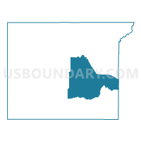
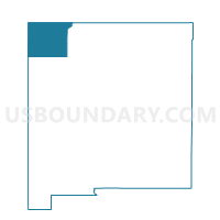
Outline

Summary
| Unique Area Identifier | 624019 |
| Name | San Juan County Precinct 16 |
| County | San Juan County |
| State | New Mexico |
| Area (square miles) | 657.79 |
| Land Area (square miles) | 657.71 |
| Water Area (square miles) | 0.08 |
| % of Land Area | 99.99 |
| % of Water Area | 0.01 |
| Latitude of the Internal Point | 36.40714080 |
| Longtitude of the Internal Point | -108.01518490 |
Maps

Graphs
Select a template below for downloading or customizing gragh for San Juan County Precinct 16, San Juan County, New Mexico


Neighbors
Neighoring Voting District (by Name) Neighboring Voting District on the Map
- Rio Arriba County Precinct 29, Rio Arriba County, NM
- San Juan County Precinct 14, San Juan County, NM
- San Juan County Precinct 15, San Juan County, NM
- San Juan County Precinct 17, San Juan County, NM
- San Juan County Precinct 18, San Juan County, NM
- San Juan County Precinct 19, San Juan County, NM
- San Juan County Precinct 20, San Juan County, NM
- San Juan County Precinct 71, San Juan County, NM
- San Juan County Precinct 77, San Juan County, NM
Top 10 Neighboring County Subdivision (by Population) Neighboring County Subdivision on the Map
- Bloomfield CCD, San Juan County, NM (17,790)
- Napi Headquarters CCD, San Juan County, NM (7,185)
- Nenahnezad-Burnham CCD, San Juan County, NM (4,823)
- West Rio Arriba CCD, Rio Arriba County, NM (271)
Top 10 Neighboring Place (by Population) Neighboring Place on the Map
Top 10 Neighboring Unified School District (by Population) Neighboring Unified School District on the Map
- Farmington Municipal Schools, NM (62,279)
- Central Consolidated Schools, NM (33,082)
- Bloomfield Municipal Schools, NM (17,928)
- Jemez Mountain Public Schools, NM (1,510)
Top 10 Neighboring State Legislative District Lower Chamber (by Population) Neighboring State Legislative District Lower Chamber on the Map
- State House District 3, NM (31,169)
- State House District 2, NM (31,123)
- State House District 4, NM (28,107)
- State House District 69, NM (26,984)
- State House District 65, NM (26,930)
- State House District 5, NM (25,172)
Top 10 Neighboring State Legislative District Upper Chamber (by Population) Neighboring State Legislative District Upper Chamber on the Map
- State Senate District 22, NM (60,988)
- State Senate District 2, NM (53,101)
- State Senate District 1, NM (52,672)
- State Senate District 3, NM (41,208)
Top 10 Neighboring 111th Congressional District (by Population) Neighboring 111th Congressional District on the Map
Top 10 Neighboring Census Tract (by Population) Neighboring Census Tract on the Map
- Census Tract 9432.01, San Juan County, NM (5,702)
- Census Tract 9430, San Juan County, NM (4,823)
- Census Tract 9410, Rio Arriba County, NM (3,499)
- Census Tract 7.02, San Juan County, NM (1,232)